
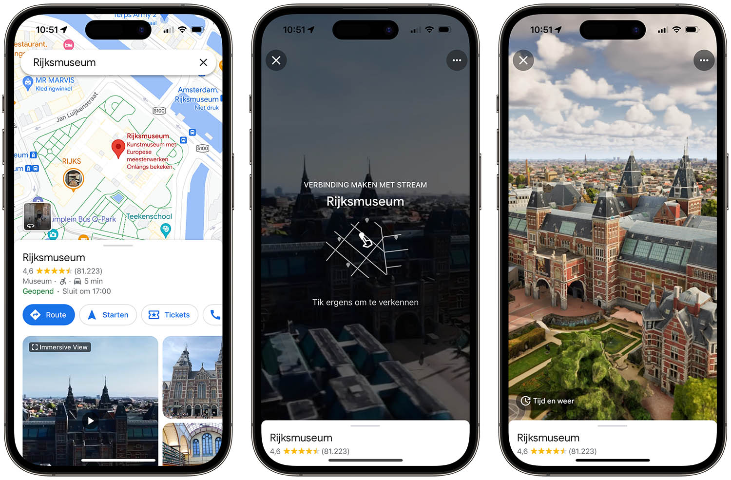
See Amsterdam in 3D with Immersive View from Google Maps
Amsterdam is one of the first European cities where this function has been rolled out. With Immersive View in Google Maps you can fly over the Royal Palace, the Rijksmuseum and the Oranjekerk and view them from all sides. It looks like a combination of Apple’s FlyOver (where you fly over a city) and Kijk Rond (Look Around) (where you see realistic photos at street level). In this tip we explain how to use Immersive View in Google Maps and how it works.
This is how you use the Google Maps Immersive View
To view the images in 3D, do the following:
- Open Google Maps on your iPhone or iPad.
- Enter a suitable location, for example the Royal Palace or the Rijksmuseum.
- At the bottom of the screen you will see an option for ‘Immersive View’. Tap it.
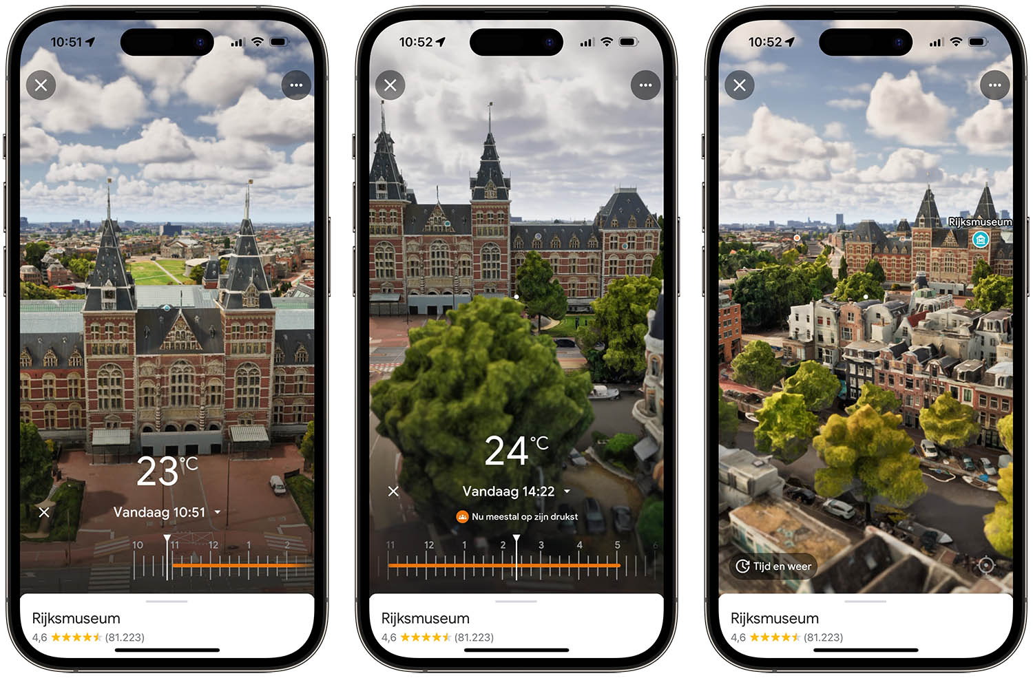
- You navigate around the building by swiping and tapping on the screen.
- Tap Time & Weather to see the local time and temperature.
- You can check the crowds at different times using the slider at the bottom of the screen.
- You can also zoom out if you want to see a better overview of the neighborhood and surroundings.
You also get to see a large part of the surrounding buildings, so you can orient yourself well. Immersive View gives a somewhat ‘colored’ effect and is less practical than Apple’s Look Around function, where you can see at street level what a building or street looks like. Apple’s function is more suitable for seeing in advance what the street of a hotel looks like, for example, so that you know whether there are nightclubs and other loud entertainment. Google’s Immersive View is intended more as a tourist orientation. If you want to look at street level, it is better to use Google’s Street View.
Google’s Immersive View plays a video, just like Apple’s FlyOver. But you can also look around yourself by moving your fingers across the screen and zooming in. If your internet connection is not fast enough, a video will automatically play of the building or the surrounding area so that you can virtually orbit around it. The images use Street View, aerial photographs and artificial intelligence.
Locations with Google Maps Immersive View
According to Google, there are already about 500 sights in the world in Amsterdam, Brussels, Venice, Florence, Dublin and other cities. For example, at the Sydney Harbor Bridge and Prague Castle it is now possible to fly 360 degrees around the area.
In the Netherlands and Belgium, the following locations can already be seen with Immersive View:
Amsterdam, The Netherlands):
- Royal Palace
- Rijksmuseum
- Orange Church
- Spoorzicht Nature Park
- TonTon Club restaurant and arcade
- Q-Factory pop venue
Brussels (Belgium):
- Atomium
- Belfry
- Church of Our Lady
Google promises that thanks to artificial intelligence it is also possible to check live at any time of the day how busy it is, where the entrance to a building is located and to get an impression of the weather. Google thinks that the new function is also perfect to use to prepare a holiday abroad. The company writes in the press release: “You can view the Ponte Vecchio in Florence or Saint Patrick’s Cathedral in Dublin from home to get an impression of the place and the environment around it. And once you arrive at your destination, you can immediately check how busy it is or look at the weather forecasts at a specific time by moving the timeline.”
You can find more tips for Google Maps here:
- These are the best tips to get even more out of Google Maps
- Cycling with Google Maps: this is how you use the bicycle view
- Google Maps is more versatile than you think: you can do this on iPhone and iPad
- Google Maps for wheelchair users: plan routes and find suitable locations


